Biodiversity - 77
i
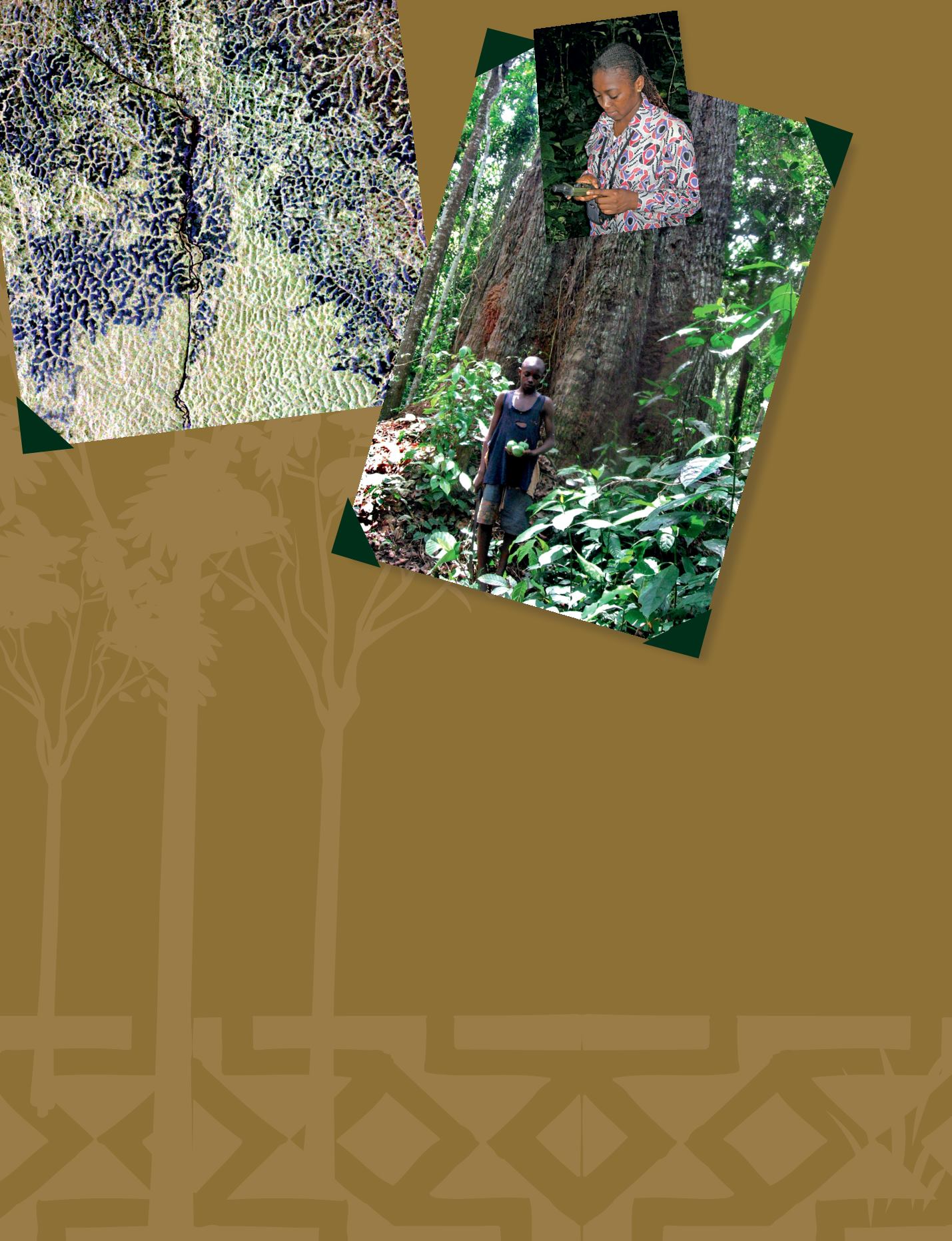
ALOS-PALSAR image of the Adamawa site in
central Cameroon. Mosaic of two image tracks
acquired at the end of 2009 and the end of 2010.
The area encompasses the interface between
humid forest in the South (bright green colour) and
savannah (dark purple colour) with narrow gallery
forest in the North. A mosaic of forest patches
and savannas on plateaux lies between these two
ecosystems.
© CESBIO
o
The GEO Global
Forest Observations
Initiative (GFOI)
will support
countries to establish
cost-effective and
sustainable National
Forest Monitoring
Systems (NFMS)
in a manner that is
both consistent with
international guidance
and respects national
sovereignty. Sustained
availability of satellite data,
methodological advice and
associated capacity building
comprise the key country
support services being developed.
Here ,
a technician with a GPS
handset, useful for tracking the
evolution of the sampled trees in a
dedicated area.
© Peter Mbile
‘scientific knowledge’. There are attempts
today to build bridges between scientific
and indigenous knowledge about forest
species as a part of sustainable forest
management. Nevertheless, these remain
subsidiary to ‘official’ state protocols,
and partly consist of re-branding local
and indigenous knowledge as scientific
knowledge, inadvertently disempowering
local people.
Satellite mapping
Who protects forests in West and Central
Africa? If the perceived enemies are local
communities, then the
de jure
‘protector’
is theMinistry of Forests. Even then, plenty
of cases exist at local level where by-laws
developed as a part of local traditions and
customs are used to protect forests from
‘outside’ users and fromover-exploitation.
In such cases the local communities are
the
de facto
protectors of the forests, as
states do not have the logistics required
to ensure comparative effective presence
enjoyed by local communities. In more
progressive countries, some of these by-
laws have been mainstreamed and linked
with ‘formal laws’ to strengthen, not forest
protection
per se
, but community-based
forest management, bringing together
state and local actors.
Satellites have and continue to help in
managing forests as a unique source
of information. However their actual
usefulness in managing and protecting
forests is over-sold. Satellites can help
in more accurate mapping of forests,
detection and quantification of forest
dynamics such as loss and degradation,
not necessarily because their accuracy is
self-evident but because they can be more
cost-effective, given acceptable accuracy
levels, than orthodox means. Real-time
workinmonitoringforestdynamicslikefire,
encroachments, etc. are being promised
but remain more challenging in practice
than may seem in theory. Especially
challenging is translating satellite imaging
and information into concrete ground
action. Unless this transition happens,
the role of earth observation satellites in
forests management will remain strong on
potential or pictorial value but of limited
value in practice.
Satellite technology can help make
Reducing Emissions from Deforestation
and forest Degradation [REDD] become
a reality. One of the current problems
with this mechanism however is what
the scope of consensus should be with
regard to minimum acceptable levels
of scientific accuracy in deforestation,
degradation detection and carbon
emissions estimates. This lack of clarity
in scientific consensus is compounded by
lack of leadership by national institutions
and capacity to receive satellite data of
known quality and regularity, to produce
information of known and acceptable
accuracy. The unknowns remain too
many. There is still considerable latitude
however for negotiations about satellite
imagery availability, scope of decisions
and levels of acceptable accuracy, quality
control, logistics and human resources
available for their handling.
c
Peter Mbile
Integrated Natural Resources
Management specialist
Cameroon


