mangrove forests and their potential
for delivering ecosystem services for
local people. As a major objective, the
temporal changes in forest area and
biomass for Kenya mangroves will be
determined. The data will be used to
classify mangroves of the pilot area
into productive (high biomass) and non-
productive stands. Such a classification
is useful in the development of
management plans for sustainable
utilization of mangrove resources.
Need for high resolution
Earlier initiatives, in the 1990s, to map
world mangroves with sufficient details
failed because satellite data with coarse
spatial resolution (approximately 1 km)
were used. The current World Atlas
of Mangroves produced through FAO
and other organizations used Landsat
imagery and other sources to map 98,6%
of the world’s mangroves. It is a major
milestone in mangrove conservation,
with data of broadly consistent age and
resolution.
The database enables comparisons
over geographic space and sets down
a baseline for assessing future change
over time. Such a global initiative could
be validated using local data sets and
high-resolution satellite data such as
QuickBird, IKONOS or even SPOT XS
imageries. In Kenya, high resolution
Quickbird imagery was successfully used
to characterize species composition of
mangrove at Gazi bay.
The high costs of most commercially
available
high-resolution
satellite
imagery preclude their routine use in
many developing countries. Projects
without substantial funding resort to
using freely available Landsat imageries
and Global Land Cover for vegetation
mapping. This might cause particular
problems in habitats that are fragmented
or linear, such as mangroves. In
addition extensive cloud cover (which is
particularly common in coastal areas)
reduces the accuracy and usefulness of
the Landsat in mapping mangroves and
the associated biodiversity.
c
Gitundu Kairo,
Mangrove Management consultant
c/o Kenya Marine and Fisheries Research
Institute, Mombasa, Kenya
o
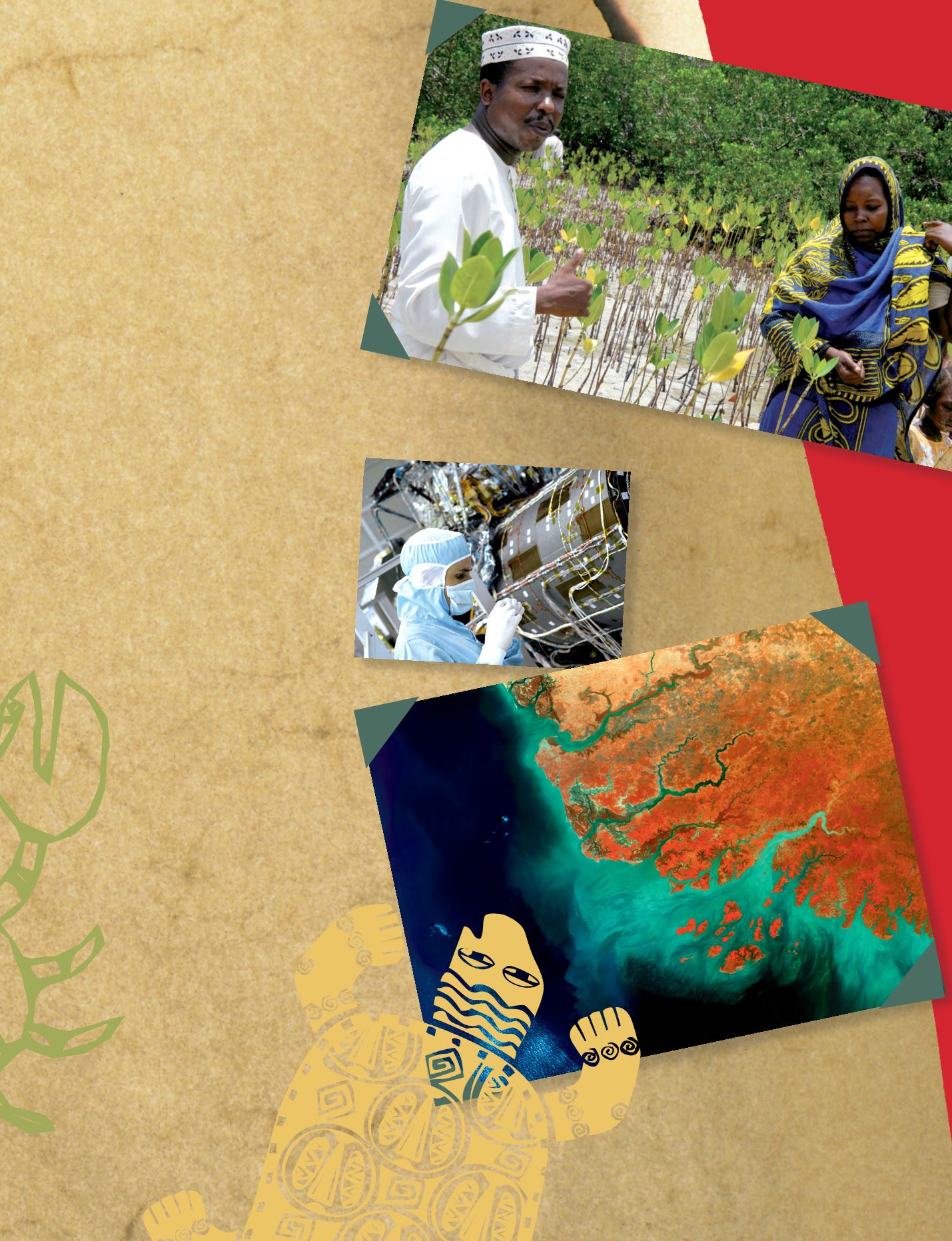
Submetric resolution optical instrument
Pleiades in assembly room. The two satellites
Pleiades -HR 1 and 2 are each equipped with
this instrument.
Thales Alenia Space © Yoann Obrenovitch
i
Envisat/MERIS image showing the vegetated
coastal plains of Guinea-Bissau (with its Bijagos
Archipelago), the Gambia and southern Senegal
(in red). Serpentine, mangrove-lined tidal rivers
feed the rias. The ‘hook-shaped’ Cape Verde
peninsula appears to the north.
© ESA 2004
i
Mangrove plantings in Pemba Island,
Zanzibar. Its wood is used for building, because
the salt protects it from being attacked by insects.
© Carl Safina.
Biodiversity - 73


