Soils - 65
i
Cotton is the main source of foreign currency for Mali and
Burkina Faso (here near Ouagadougou).
© Joerg Boethling/agenda
i
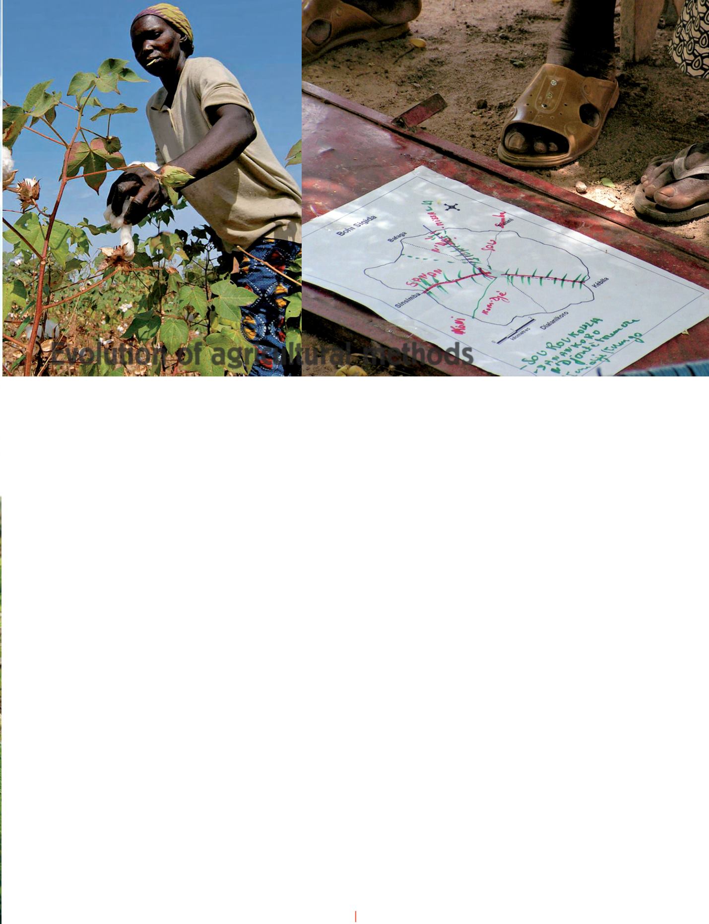
Maps are used by scientists to show the situation of fields around Kebila in the Sikasso
Region of southern Mali.
© Mamy Soumaré
I
ncreasing agricultural production in
Sudano-Sahelian Africa is achieved
mainly by increasing cultivated areas.
However, demographic growth is 3% per
year, with a doubling of the population
every 20 years, and one can wonder if land
resourceswill besufficient tomeet demand
for food. Cotton growing developed in Mali,
as elsewhere inWest Africa, forming a true
agricultural revolution. Total cultivated
area increased from 60 000 to 600000
hectares, production from40000 to 600000
tonnes and the number of draught oxen
from 100000 to 600000 in 30 years. This
leap in quality enabled farmers to develop
a new farming system for their land.
Cultivated land and fallow
Fallow was gradually abandoned and the
age of fields under continuous cultivation
increased. This was seen by combining
satellite images, maps as reported
by stakeholders and the geographical
positions of the fields of 15 farmers chosen
according to the diversity of their practices.
All the fields cultivated in 1985 still are
whereas cultivation rarely exceeded 5 years
in theoldsystem. Aerial photosandsatellite
images can be used not only to reconstruct
the history of land occupation but also
to show the present situation. Farmers
identify the main domains—cultivated
land and fallow—from a simple coloured
composition on the green, blue and red
channels. This pilot work is to continue
during the next three years within the
framework of the
Programme d’Appui aux
Systèmes d’Exploitation en Zone Cotonnières
du Mali
(PASE2, ‘Support Programme for
Farming Systems in the Cotton Belt in
Mali’) under the direction of the Chamber
of Agriculture and with support from
Agence
Française pour le Développement
(AFD,
French Development Agency).
The elimination of fallow reduces the
frequency of land clearance and slash-and-
burn. The halting of bush fires, which are
the main source of CO
2
emission in African
agriculture contributes to improving the
carbon balance. Transfer of matter results
in an increase of the fertility of cultivated
soils whereas it falls when crops and fallow
are alternated. The viability of such a system
depends on the presence of sufficient head
of livestock to ensure transfer of fertility
and also that of pasture to feed the animals.
Farmers must improve the productivity of
the pasture to ensure the sustainability of
the system, but this is a problem in zones
with high population density as in the old
Mali cotton belt.
Prospects for action
The involvement of stakeholders in the
production of maps makes it possible to
compare the viewpoints of technicians and
users. There are numerous constraints:
the languages used are different and
stakeholders tend to censor their
expression and align their viewpoint with
that of dominant thinking: the slogans
uttered by politicians and by certain
development bodies. However, the
knowledge produced jointly helps the user
in his work and enriches the analysis made
by the researcher.
Developing newmethods
Technicians must use tact and pedagogic
skills.
In
participative
diagnosis,
stakeholders said that shortage of land
was a major difficulty in a context where
the ratio of cultivated to non-cultivated
land is 1:3 or even 1:5 and that fields can
be further enlarged. How is it possible to
make themunderstand that this constraint
is not a valid one in their context? This is
all the more delicate as people’s word is
strongly significant, and there is above all
a practically religious obligation for young
people to respect their elders.
The data will be updated in five places
in Mali using SPOT5 images collected in
2007. The changes observed will be used
for forecasting and for developing new
methods for managing areas. Based on
this study, management plans will be
developed, incorporating biomass flows
between the various components and
grouped rotations. All that on the basis
of successful discussion between all the
stakeholders.
c
Dr Mamy Soumaré,
University of Bamako
Mali
Evolution of agricultural methods


