58 - Sustainable Development in Africa & Satellites
One of the major outputs at this level
is the plant production map quantifying
available biomass. Its immediate use is
the guiding of transhumance to zones
where forage is available.
At the halfway point and at the end
of the rainy season, environmental
watch bulletins on ‘Monitoring of
agricultural and pastoral zones in
Senegal using remote sensing and
geographic information systems’ are
published for partners of the CSE, of the
Multidisciplinary Group that monitors
the agricultural season, national
decision makers and development
partners. The work of the CSE is thus
completely integrated in the national
system for agricultural and pastoral
monitoring and serves to support the
work of development projects operating
in this field. This context ensures the
information input in the decision process
and feedback from those who receive it.
Combining satellite and field data makes
it possible to identify drought four to six
weeks earlier than before and describe
it more accurately; to this must be added
the possibility of assessing the impact
on agriculture well before the harvest in
order to facilitate decisions concerning
food security. The advantages of satellite
data for drought assessment lie in certain
intrinsic features of remote sensing: a
synoptic view of a large zone at various
scales, continuous archiving allowing
retrospective studies and comparisonwith
the present situation, good data reception
frequency and often at a reasonable cost.
One of the issues for the future is the
continued supply of this information, that is
to say continuing observations. Institutions
like the CSE must continue to ensure the
long-term viability of projects. The main
challenge is that of being able at the end of
the project to incorporate the achievements
in the regular environmental monitoring
activities performed by institutions.
Decision makers must understand this
necessity. This is a battle to be won but we
remain optimistic.
Appropriation by communities
We should not forget that we are working
for the good of the populations and so the
human aspect is very important. Attention
must therefore be paid in this problematics
to the integration of local and endogenous
knowledge. First of all the right questions
must be asked. What is the value-added
of what we propose in comparison with
what farmers know? What is its social
usefulness? How is it perceived by the
population? Finally, we must be aware that
we do not use the same reasoning and
thus abandon our ‘laboratory language’
for that of experienced reality to provide
better information. Appropriation of our
output by these communities is essential.
As an example, mention can be made of
the NICT project entitled ‘Use of NICT in
the temporal monitoring of transhumant
cattle by basic communities for the
sustainable management of Sahel pastoral
resources’ with the participation of Fulani
herders in the development of outputs, and
especially maps in their language. This
is a fine example of the appropriation of
tools. These issues must be integrated in
the everyday experience of populations in
order to succeed the advent of sustainable
development.
c
Dr Jacques-André Ndione,
Dr Abdoulaye Faye et M. Gora Beye
Centre de Suivi Écologique
Dakar, Senegal
i
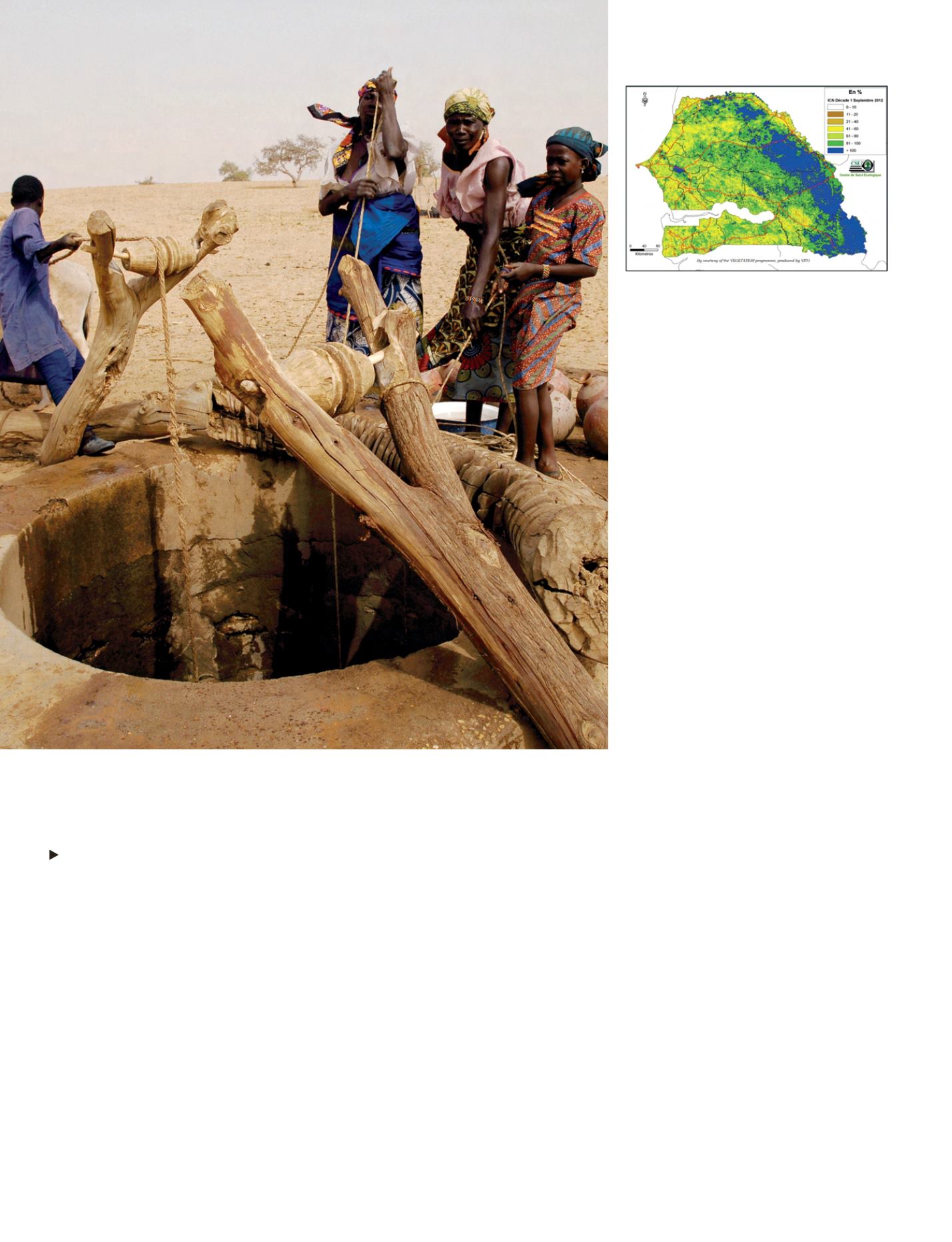
Vegetation Condition Index for the first 10 days of
September 2012. Data Map J.-A. Ndione. Courtesy
of the VEGETATION programme, produced by VITO.
i
Traditional well, about 100 meters deep, at Kankaren Kashe village, in south-center Niger. Three
major food crises in the last seven years (with a severe drought in 2011/12) have significantly weakened
the livelihoods and resilience capacity of small-scale farmers. Combining satellite and field data makes it
possible to identify drought earlier than before.
© Jon Warren/World Vision


