84 - Sustainable Development in Africa & Satellites
Pr. Rolph A. Payet
What is the role of satellites and satellite-
based applications?
T
hese are very, very important for
research, planning, ecosystem
management and also enforcement.
They can save us because we have
limited capacity. We can develop the right
algorithm to detect changes, for example
ecosystem threats like extreme weather
events, before the damage happens.
We have for instance significant algae
blooms and these can destroy fisheries, or
beaches. We had a project with fishermen
combining the use of planes and satellites
to determine the impact of bleaching on
coral reefs.
Then on the issue of management,
satellite imagery will help us determine
places which have been eroded the most,
land use, urbanisation. But a lot of the
planning tools lack up-to-date satellite
information and that is why they are never
used. Mauritius has just completed its
area mapping. The last one we did was
15 years ago and a lot of things have
happened since.
Another example is the piracy issue.
For example, Reunion Island developed
applications which can identify legal and
illegal boats and other kind of activities
around fisheries in the West Indian Ocean.
In satellite information we do not use
only pictures but also data: temperature,
pressure, weather, wind… These
parameters help us to manage the coast,
the resources along the coast and also
movement of people, urbanisation….
So we need to develop satellite-based
applications that are for us one of the
most important tools to manage an area
of sea greater than France and Spain
together.
What are the main satellite data you use
and what difficulties do you encounter?
We are using European data (SPOT
from CNES) and a little data from Indian
satellites (like IRS from ISRO). It depends
on what we are looking for and on the
region. Apart from cloudiness, the first
difficulty is the cost: satellite data are
still very expensive. The second one is
processing capacity for interpretation
of the data. We are in the process of
developing a project with SEAS-OI center
in La Reunion to allow the data to be
processed elsewhere and sent to the
stations in two years time.
Concerning the environment, one of the
most important continental programmes
is AMESD. In the IOC region, the Mauritius
Oceanographic Institute leads the
development of operational services for
the management of fisheries resources
and the control of fishing activities but
also for physical oceanography and
marine climatology. Those services
will benefit not only IOC member
countries — Mauritius, Seychelles,
Comoros, Madagascar (Reunion Island
as associate)—but also Kenya, Tanzania,
Mozambique and two small associated
island states: São Tomé and Príncipe and
Cape Verde.
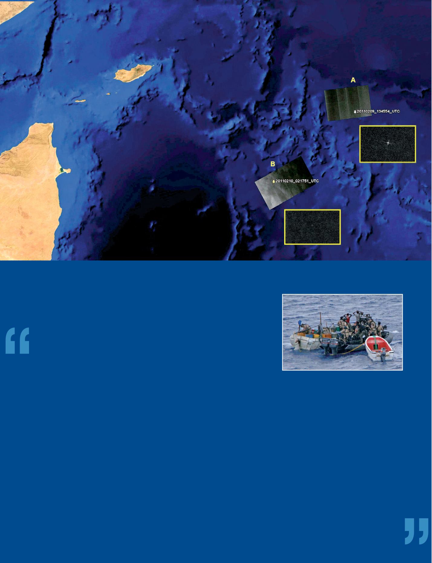
c
On the watch, night and day
i
Satellite images of the Italian oil tanker ‘Savina Caylyn’, captured by pirates in the Indian Ocean. A and B represent successive positions of the boat, seen as a white
dot on the zoomed views. The Emergency Team of e-GEOS, an ASI/Telespazio (Finmeccanica/Thales) company, acquired these COSMO-SkyMed images in February 2011.
© ASI/Italian MoD
i
European Union Naval Force in action off
the coast of Somalia. Operations against piracy
are conducted in accordance with UN Security
Council’s resolutions.
© EU NAVFOR


