i
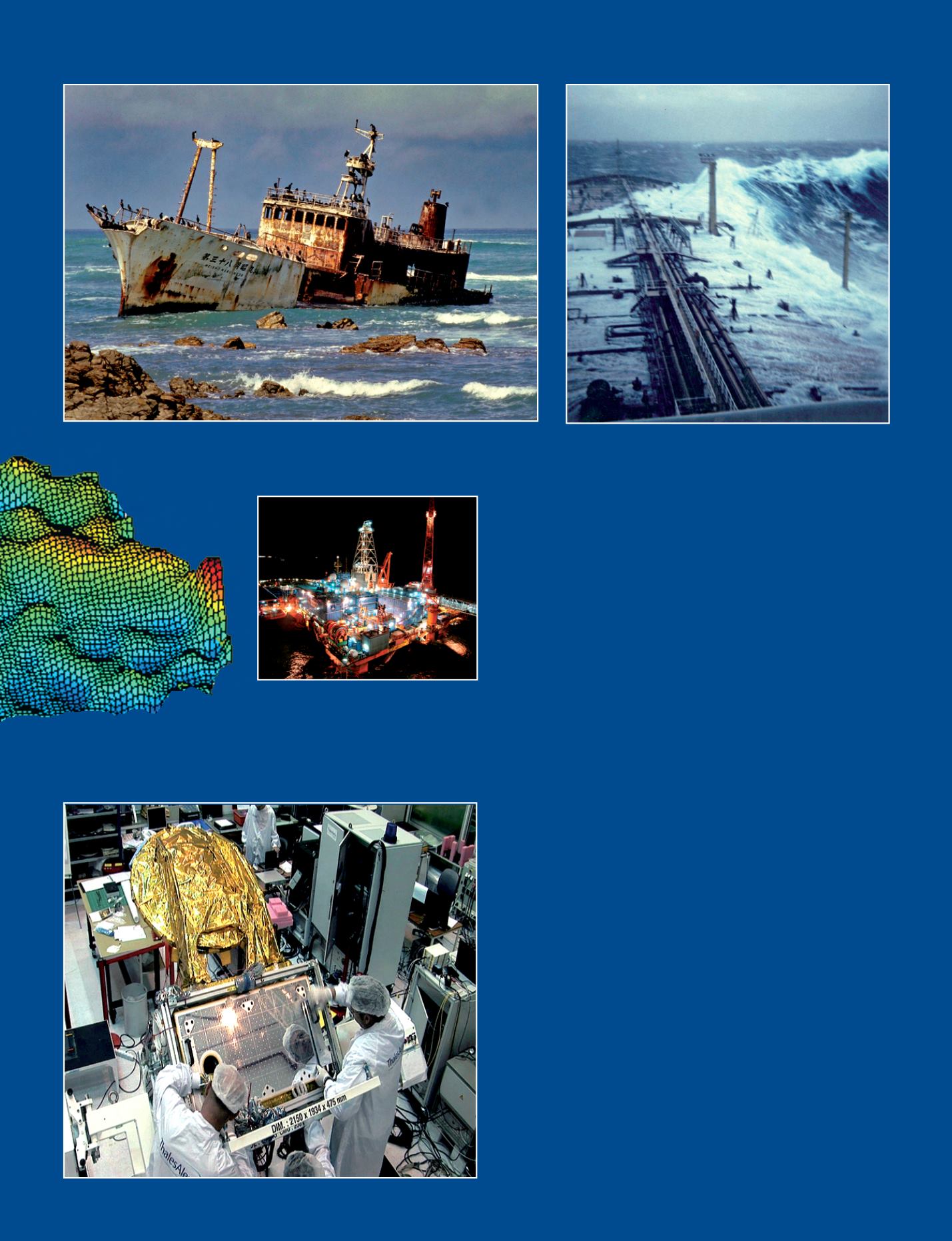
The Meisho Maru, a Japanese tuna fishing vessel wrecked in 1982 at Cape Agulhas (‘Cape of Needles’ in Portuguese) well-known for its rogue waves.
All 17 crew members swam safely to shore. This southernmost point in the continent of Africa is now an attraction of the Agulhas National Park.
© All rights reserved
u
A rogue wave breaks over the supertanker Esso Languedoc in the Agulhas current off Durban, South Africa, in 1980.
© Philippe Lijour
Seas - 89
o
The Rosa field, 135 km off the coast of Angola in water depths of 1350 m.
© All rights reserved
t
SARAL satellite, cooperation between
CNES and ISRO (the Indian space agency)
is studying oceans with an altimeter in Ka
band. Here, the payload module during
integration.
Thales Alenia Space © Suds-Concepts
coastal zone management. Space agencies also started to
produce altimetry products dedicated to coastal areas such as
PISTACH (CNES), COASTAL (ESA), ALTICORE (EU/INTAS) and the
forthcoming ALTICORE Africa.
Ocean Data and Information Network for Africa (ODINAFRICA)
isacentre that brings togetherover40marinerelated institutions
from 25 countries in Africa. The aim of the centre, with the data
and information management unit based at the University of
Ghana is to ensure that local, regional and global marine and
coastal data are made accessible to users in Africa. It serves
as the regional sea level monitoring facility. ODINAFRICA also
developed the African Marine Atlas where all tide gauge and
other geospatial data are collected to form an atlas suite.
With the coordination of organisations such as the Europe-Africa
Marine Earth Observation Network (EAMNet), the Global Ocean
Observing System in Africa (GOOS-Africa), African Monitoring of
theEnvironmentforSustainableDevelopment(AMESD)andother
African marine and academic institutions, a new generation of
young scientists will be making greater use of satellite altimetry
data than ever before. AMESD for example, extends the use of
operational Earth observation from the meteorological point of
view to environment and climate applications.
Tostrengthenabroaderparticipation inclimatestudies, countries
in Africa that have space agencies, which include Algeria, Egypt
and Nigeria, might incorporate ocean-observing systems in their
research. This would enable African researchers or academic
institutions to cover all aspects of environmental studies
and be an integral part of the data collection, dissemination
and validation essential for the monitoring and prediction of
environmental change.
c
Dr. IbrahimMuhammed (Nigeria)
Dept of Surveying & Geoinformatics
School of Environmental Sciences,
Modibbo Adama University of Technology


