Risks - 97
i
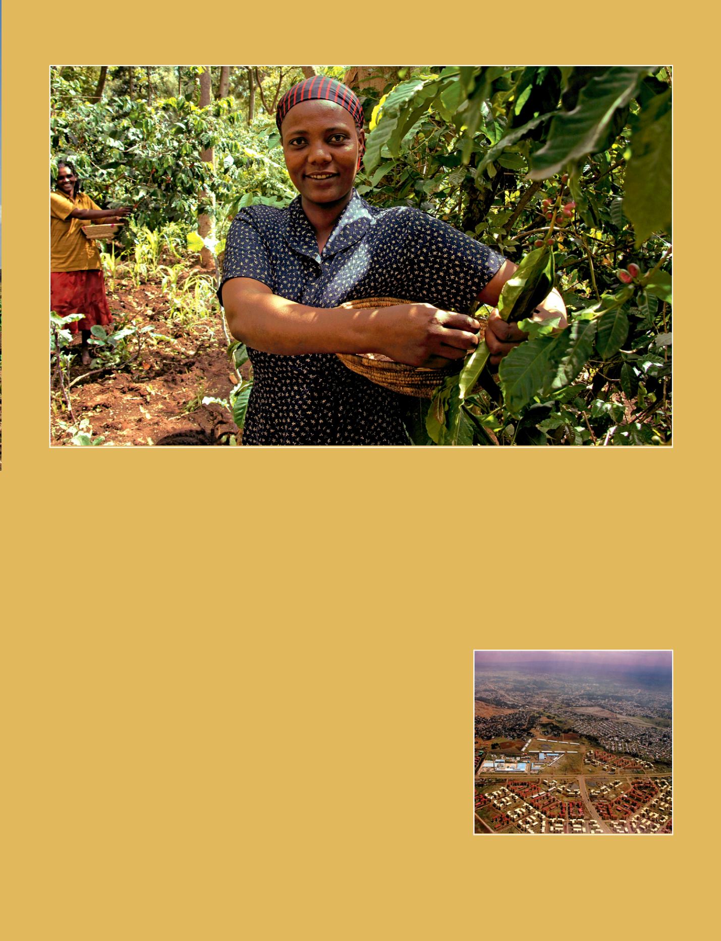
Balainesh and Adelgaino picking coffee at their plantation in Wondo Genet, in the Sidamo region, famous for its high quality coffee. Coffee is Ethiopia’s largest
export, which generates 60% of its total export earnings.
© J.D Dallet/Suds-Concepts
the Forum for Environment, Forum for
Social Studies and others. The Ministry of
Agriculture, the Ethiopian Environmental
Protection Authority (EPA), regional col-
leges and universities of agriculture, and
individual researchers at universities, re-
search organizations and NGOs are quite
often the ones taking the lead in addres-
sing this issue.
An example of mitigation of land degra-
dation could be seen beginning from
Arsi Negele up to Awasa and further
South. This is mainly due to traditional
soil conservation practices such as agro-
forestry, mulching, crop rotations and
other similar measures. We were able
to observe a good amount of ficus trees
mixed with a variety of both vegetable and
agronomic crops. Moreover the farmers
have a tradition of growing crops such as
onions, soybeans and potatoes during the
early rainy period which they replace with
wheat immediately after harvest; thereby,
introducing crop rotation in their farms at
the same time keeping the land covered
with vegetation throughout most of the
year. Coffee is known to be an important
source of income to many farmers. It also
brings substantial amount of foreign ear-
nings to the country. Farmers in Wondo
Genet tend to grow coffee together with
other crops which could be considered as
a soil erosion mitigation measure tool.
Satellites will help in the near future to
manage the land degradation risk. The
Ministry of Agriculture started using sa-
tellite imagery to assess the woody bio-
mass of the country in mid-1990’s, which
was active until about 2004 when the
Project phased out. The Woody Biomass
Project was supposed to build capacity in
using satellite data to assess the status of
woody vegetation cover, which could have
been expanded to cover documenting and
monitoring land degradation. But this did
not materialize and there has not been
any effort to build capacity of the Minsitry
to make use of the satellite data.
Building capacity with AMESD
In this sense AMESD IGAD service may
help in building capacity to enable mem-
ber countries to assess and monitor land
degradation.
The first objective is to identify extent and
severity of land degradation at the regio-
nal and national levels and to identify
local spots for comprehensive assess-
ment. Its outputs aim to support policy
decisions for combating land degradation
at regional level. It will also give more de-
tailed information of the sections of IGAD
countries experiencing severe degrada-
tion so that appropriate planning of the
national resources could be instituted.
c
Pr. Fisseha Itanna
Faculty of Life Sciences
College of Natural Sciences
Addis Ababa University
Ethiopia
i
Addis Ababa is currently facing land degradation
due to urbanization and industrialization resulting
in physical sealing of soils, and contamination of
ecosystems with pollutants such as heavy metals.
© J.D. Dallet/Suds-Concepts


