right strategies and mechanisms to
address disaster risks. We also want
to improve our use of new technologies
like satellite data / information, not only
for risk assessment and management
but also to increase awareness of policy
makers of the issues at hand. If you
want to achieve their political will, you
can use satellite data / information or
satellite images to show the extent of
disasters. Africa is a big continent and
with satellite imaging you can show a
large affected area in one scene. This is
a good tool for supporting the cause of
Sustainable Development. In addition to
the policy makers, we have to increase
the awareness of the general public.
Satellite data can help here too. By
using time series showing the impact
of disasters such as deforestation,
drought and erosion, we can explain
‘This is what is happening because
you are doing this or that; you have to
refrain from putting too much stress on
the environment’.
Monitoring the environment
We can present this to technicians but
I think that schools would be the best
because they are the most outreaching
structures. Secondary and elementary
schools in remote areas where you can
show a film are most suitable. Pupils
will tell their parents, the community
and help to initiate the move towards
Sustainable Development.
This is what is happening inNganyi Village
in western Kenya where community level
interaction includes schools, youth and
community in indigenous knowledge
integration in disaster risk reduction after
the release of local level seasonal climate
forecasts.
Satellite data/information can be used
as an early warning system or tool by
identifying risks before consequences
occur, for instance for drought, floods
or food security. You can then integrate
disaster risk in emergency responses.
Applications can even be broader: it can
be used for monitoring the environment
as is seen in AMESD. Satellite technology
can provide data / information for
integrated planning. For example if
you have achieved good territorial
planning and land use planning, you
are in a good position to implement
Sustainable Development. Africa is too
big to have this kind of detail planning
on the ground. The use of satellite
data / information makes it easier and
cheaper.
Of course there are limits. Themain ones
are education, awareness and creation:
we need to show people what happens
after a certain time of mismanagement
or action. Look at forests: there is a
movement to make sure that every piece
of wood used is certified as coming from
sustainably managed forests. But this
generates a big debate about priorities.
People agree that access to market is
a development issue and it is difficult
i
A girl has her arm measured as part of a weekly
nutritional assessment organized by DIAL, a
local NGO and UNICEF partner, in Ras Kamboni,
Somalia (July 2012).
© Kate Holt/IRIN
i
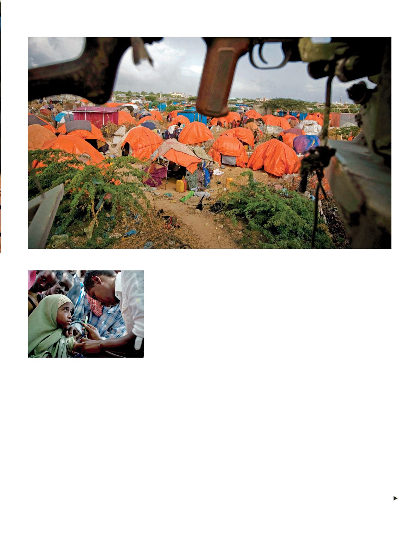
Orange plastic huts are seen underneath a gun handle of an AU convoy in Badbaado Camp that was established for people who have come to Mogadishu from
areas of Somalia where a prolonged drought has affected them for nearly four years (July, 2011).
© Kate Holt/IRIN
Risks - 93


