Geological Survey. The first satellite was
launched in 1972 . LANDSAT 7 was launched
in 1999 and is equipped with a multispectral
sensor (Enhanced Thematic Mapper Plus -
ETM+). The Landsat Data Continuity Mission
(LDCM) is currently the name of the next
Landsat satellite mission.
Meteosat
Name of the operational geostationary
weather satellites programme developed
with ESA and EUMETSAT. The first satellite
was launched in 1977. The first Meteosat
Second Generation (MSG) satellite was
operational in 2004 while the second was
launched in 2005. Two further MSG satellites
should guarantee continuity of service
through to around 2021. Data are available
via the EUMETCast dissemination system at
the PUMA and AMESD stations installed in
most countries in Africa. The Meteosat Third
Generation (MTG) satellite programme is on
the way, which will consist of two parallel in
orbit positioned satellites, the MTG-I imaging
and MTG-S infrared and ultraviolet sounder.
MetOp (Meteorological Operational satellite
programme)
MetOp-A is the first polar orbiting (at 800
km) satellite from the MetOp programme
managed by ESA and EUMETSAT in
cooperation with the National Oceanic and
Atmospheric Administration (NOAA).Data
are progressively available at the PUMA
and AMESD stations via the EUMETCast
dissemination system.
MODIS (Moderate Resolution Imaging
Spectroradiometer)
MODIS is a key instrument aboard the Terra
and Aqua Low Earth Orbit (LEO) satellites of
the NASA administration, acquiring data in 36
spectral bands, or groups of wavelengths.
NigeriaSat
General name for the earth observation
satellites of the Nigerian National Space
Research and Development Agency
(NASRDA). NigeriaSat-1 was launched in 2001.
NigeriaSat-2 and NigeriaSat-NX, equipped with
multispectral imagers, were launched in 2011.
PLEIADES
Pléiades (a programme initiated by the
CNES) consists of two ‘small satellites’ with
spatial resolution of 0,7 m at the nadir and
a 20 km field of view. Their agility provides
daily access at all points of the globe and
cover capacity that is essential for better
scales than those possible with the SPOT
family of satellites.
PUMA (Preparation for the use of Meteosat
Second Generation satellite in Africa)
The PUMA programme, funded by the
European Commission (EC), assisted 53 African
countries and 4 regional meteorological
centres with computers, satellite receivers,
training and application support for receiving
meteorological data. Thales Alenia Space
manufactured and implemented these
stations between 2004 and 2005.
QuickBird
An earth observation satellite operated
by the American company DigitalGlobe. It
carries an optical instrument with spatial
resolution to less than one metre.
RASCOM (Regional African Satellite
Communications Organisation)
RASCOM is an intergovernmental
commercially run organization, bringing
together 45 African countries. RASCOM’s
main objectives are to design, implement,
operate and maintain the African
telecommunications satellite system.
The Rascom-QAF 1R is in operation.
SARAL (Satellite with ARgos & Altika)
The CNES and ISRO (the Indian space agency)
are handling the SARAL satellite project jointly.
The CNES provided the MCU SARAL payload
that contains an ARGOS instrument and a new
generation Ka-band altimeter: Alti-Ka. The
SARAL mission is for study of oceans and the
continuity of the ARGOS system.
SMOS (Soil Moisture and Ocean Salinity)
The SMOS mission is an ESA, CNES and CDTI
joint observation programme providing soil
moisture and ocean salinity maps. The data
used is from the microwaves radiometer
carried by the SMOS satellite launched at the
end of 2009.
SPOT (Satellite Pour l’Observation de la Terre)
A civil earth observation programme
launched in 1978. It operates with low Earth
orbit satellites carrying high-resolution
optical and infrared instruments. Five
satellites have been launched. Data are
distributed by the SPOT Image company.
SumbandilaSat
South African microsatellite put in orbit
in 2009. Its high-resolution imager gives
data mainly used for agriculture, mapping
of infrastructure and land use, population
measurement and the monitoring of
reservoir levels.
TIGER
Following the 2002 Johannesburg World
Summit on Sustainable Development, the
European Space Agency launched the TIGER
Initiative—focusing on the use of space
technology for water resource management
in Africa and providing concrete actions to
match the Resolutions.
VEGETATION
The VEGETATION instrument consists of
an imager system functioning in the visible
spectrum at 1 km spatial resolution. The two
VEGETATION instruments are passengers
of satellites SPOT4 and SPOT5. Service
continuity is provided by PROBA V and
Sentinel 3. The distribution of VEGETATION
data is handled by VITO (Mol, Belgium).
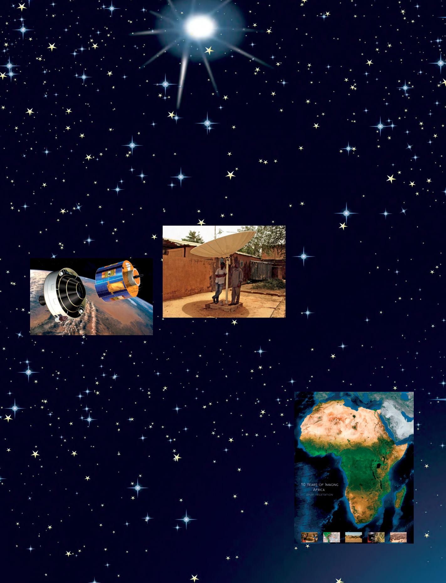
Meteosat Second Generation
© ESA
Africa, vegetation
© Vito, Spot Vegetation
Puma station
© Telespazio
123


