i
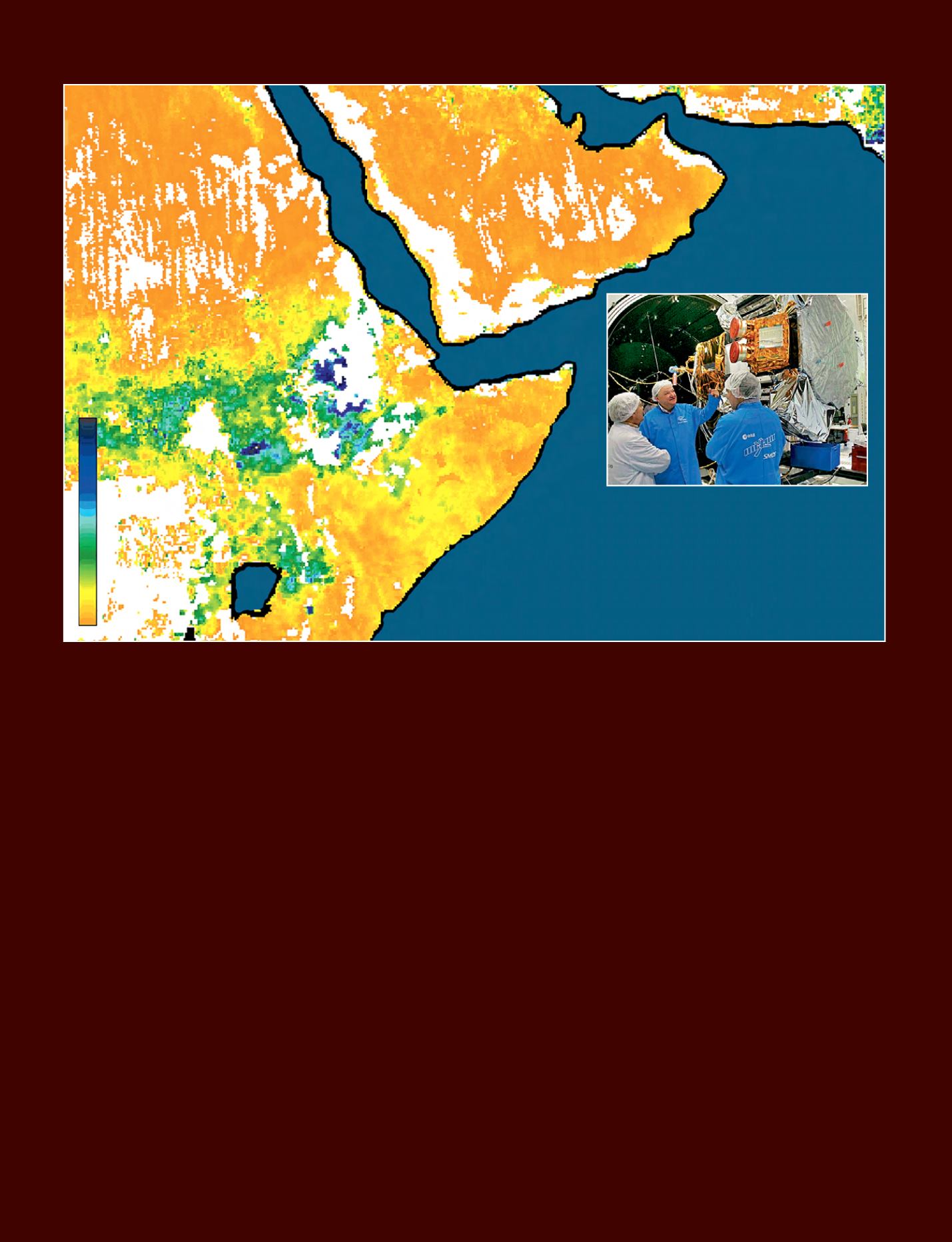
Drought in Somalia, Kenya, Ethiopia and Djibouti is pushing tens of thousands of people from their homes. This image, derived from SMOS satellite data,
shows soil moisture in the Horn of Africa in July 2011.
© 2011 ESA/CESBIO
B
etter knowledge of the effect
of climate on the composition
and quality of cultivated soils
is essential for determining crop
management sequences that match the
land. The promotion of scientific research
is therefore essential, especially in the
field of the environment (agro-pedo-
climatology).
Africa and Europe have a long history of
cooperation in spatial remote sensing at
the service of sustainable development in
Africa. Numerous institutions such as the
African Union and the European Union
and certain bi-national cooperation work
have implemented programmes aimed at
using satellite data.
The agricultural scientific research
sector in Ivory Coast is one of the best
in the field of cacao but the budgets
have shrunk considerably since the
1990s. Funds are devoted mainly to
‘conventional’ research: improvement
of germplasm, disease management,
etc. There is insufficient consideration
of environmental factors, adaptation to
climate change and the study of cacao
agro-ecosystems.
Budget constraints and research
priorities are not the only reasons. Ten
years of political crisis means that the
network of environmental observation
instruments has not been maintained
and developed. This slows understanding
of the evolution of climatic factors and
the impacts of climate change.
Agricultural and environmental field
research can be consolidated by data
gathered in space by observation
satellites. Long times series of such
key environmental data such as rainfall,
temperatures and evapotranspiration are
available.
The role of space applications
Programmes have been implemented by
the European Union and its organisations
to use spatial data in Africa. The first
step was to make available to African
specialists data such as those from SPOT
satellites, providingmapping of natural or
agricultural plant resources (VGT4Africa
programme), or fromENVISAT and ERS in
the field of water resource management
(TIGER programme). New satellites like
SMOS measure soil moisture among
other things and the future Sentinel 4
and 5 will be devoted to meteorology
and climatology. These data are of
crucial importance for understanding
the limits of land systems. Especially by
incorporating agro-climatic dynamics at
the scale of West Africa or by collecting
new local data for which land-based
instruments are far from having high
priority in national budgets.
Strengthening user networks
Reception networks such as PUMA
and
EumetCast
for
EUMETSAT
meteorological data had to be developed
to give better access to data. Seeing
that data often remain within African
meteorological or civil aviation services,
programmes such as AMESD have been
developed to extend the dissemination
of spatial application to African research
centres.
From space to the Earth
Wetter
Dryer
i
SMOS (here its satellite during environmental
tests) is a joint mission conducted by ESA, with
the French CNES and the CDTI of Spain.
Thales Alenia Space © J.D. Dallet/Suds-Concepts
36 - Sustainable Development in Africa & Satellites


