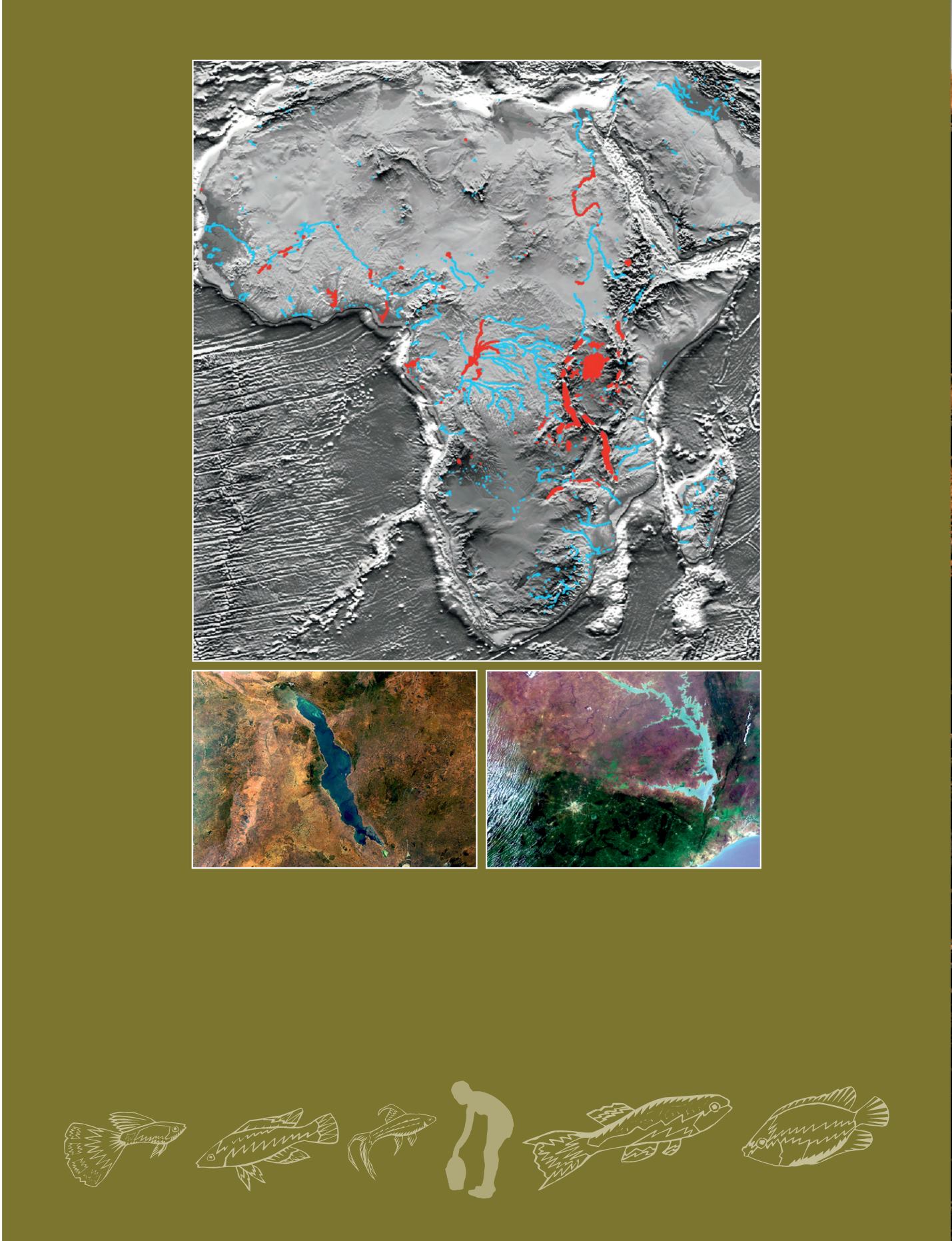
Africa’s rivers and lakes
The River and Lake system implemented by De Montfort University (UK) has been put live over Africa (top image). It delivers accurate height data over major
lakes and rivers on the African continent within a few days of data collection by the ESA Envisat RA-2 Radar Altimeter. Red indicates area where such products
are currently generated, and blue where products may be generated in the future. Managed by LEGOS France (CNES/CNRS/IRD/UPS), the Hydroweb database
provides similar temporal series of water heights on large rivers and lakes.
© DMU/EAPRS Lab, ESA 2011. ESA and DeMontfort University/EAPRS Lab are the source of this picture.
Bottom left: Envisat/MERIS image featuring Lake Malawi, situated in the Eastern Rift of the Great Rift Valley. This third largest lake in Africa is the habitat of
more species of fish than any other body of freshwater, including more than 1000 species of cichlid. On the eastern shore are Tanzania (north) and Mozambique
(south); South West, Mozambique and, North West, Zambia.
Bottom right: Envisat/MERIS image featuring Lake Volta, the largest reservoir area in the world (by surface). Because of the Akosombo Dam construction, about
78 000 people were relocated to new towns and villages. Left, South West of Kumasi city, lake Bosumtwi, situated within an ancient meteorite impact crater.
© ESA 2010 and © ESA 2004
46 - Sustainable Development in Africa & Satellites


